


adicionar à lista de desejos
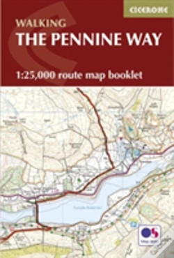
Pennine Way Map Booklet
1:25,000 Os Route Mapping
idioma: inglês
Editor:
CICERONE PRESS, setembro de 2024 ‧
ver detalhes do produto
ESGOTADO OU NÃO DISPONÍVEL
Venda o seu livro
SINOPSE
Map of the 270 miles (435km) Pennine Way National Trail, between Edale in the Peak District and Kirk Yetholm in the Scottish Borders. This booklet is included with the Cicerone guidebook to the trail, and shows the full route on OS 1:25,000 maps. This popular long-distance route typically takes three weeks to complete.
DETALHES
| Propriedade | Descrição |
|---|---|
| ISBN: | 9781852849078 |
| Editor: | CICERONE PRESS |
| Data de Lançamento: | setembro de 2024 |
| Idioma: | Inglês |
| Dimensões: | 116 x 172 x 6 mm |
| Encadernação: | Capa mole |
| Páginas: | 136 |
| Tipo de produto: | Livro |
| Coleção: | East Anglian Archaeology Report |
| Classificação Temática: |
Livros em Inglês
>
Desporto e Lazer
>
Outros Desportos
Livros em Inglês > Outros |
| EAN: | 9781852849078 |
LIVROS DA MESMA COLEÇÃO
-
The Mountains Of Ronda And GrazalemaCICERONE PRESS21,83€
-
The Pennine WayCICERONE PRESS20,80€
-
Walking On Madeira10%CICERONE PRESS21,84€
24,27€portes grátis -
Walking The South West Coast Path10%CICERONE PRESS23,06€
25,62€portes grátis