
adicionar à lista de desejos
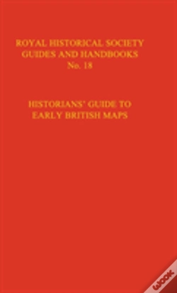
Historian'S Guide To Early British Maps
A Guide To The Location Of Pre-1900 Maps Of The British Isles Preserved In The United Kingdom And Ireland
idioma: inglês
Editor:
CAMBRIDGE UNIVERSITY PRESS, abril de 1995 ‧
ver detalhes do produto
77,06€
10% DESCONTO
CARTÃO
ZUhkR1NGVnVVelk1Ukc5Rk1qQnJjbGR0YTJOR1duUldNREJLVUZCQ2NUZEhPVzlyVldwek1tZE1hME16T1hsaVptRjRWR3B6Y0hwMGJUTlZTbmNyUlVwdGFrVndRbVZJYUZSdlowbHlja05PUlN0Qk5tTXpkbmgxWTBFd2FUSTVWVzF1TkVoM1FuVkpURkZXVjJSWlZUVTNTSFZ2UTFremQzUTBiMWROTVROdlRGWnJZazUzV0dnek9IWlRSMkZ3WkU5ck1VSklNMUpITlZadFVETk1hRk5NVVdWb2MzcE9URE5ITm1JMFpHRndSV2xHTDNsNFMwRTBlbTUzVEVkS1ZXYzBORkZEUmtoM05XdDRZbkZDYkU5a1VETkxURXBKYUdZd1VHTjBSVU5EVlRJNVpVRktXbFF6VkhwWVduRlJUalZZVkV4S2RFTk1ZbUVyYjNwcWJGTlVaM1pQVFUwMVEwWk9UREZIVUVkeVozRk9PRzVqYm5OQlZuVnhjM04xWmtoNFdWWnZiMUZxT0RaV2RHTTJabWMyTjJsVUwxcEVPRlZRZWxGalYyZExRVmgxVG1NMVpsRjRkelkzU1RCNE5VTjFkSFZvYkV4c2N6WlRja1ZOTVhKeFFVaFVWVmRrVEdsNWRrOHhSMGhYYlZOR0t6QTJkM0l5VVhkVVEwdFNhbGRoT1c1a1pVZEliRTFZYWxsdFZFNU5TRE5wVGsxU1JtWmpWbk4xU2tRME5GZFFja3htZGtkd1NpdDVWalZwT0V0NUswTTRNalU0SzJ4b1dUWnVNVUZ1VVRaaWQyVXZkMkpSZVhwVFFXaFNTMWxDUW5CSlpXNHdSVTEwWlhGRFdUQlFMME5FYTNCVGRpc3pORWt2Y1UxcFNrOHhkVzVEYVRsVlNWcDVSRVJ0ZWpSVk9WUm1la2RVTm01NkwwTklkWE41UkVjd1ZsZDRiV2RhY1VWVWNURXlWbmRzUkhScllUVlBhMlIyVEhaRWNrWllhVEJRZWpoSFpWYzVVMjFvYTBGaVIweFdVVWhFWmpRd2VEZFhaVlI1UzFFclJEVlBZMVZWVDJnd2RuY3lUbFo2U2psc2VXMTBhSEJWVFdkSlZFWXdjVGwzY0ZGUVdYZGxkbkpxT1drd01uQnJlRXhDVURBMVFWTmtXV3hrWlZGV1UxcHdZVXQ1TDFGSVEyOTFPWEJOVkRJM1JUQlJVVlkyWWxWS2VqVk5LMjFPTnpGeVpUQndhSFZQYzBobWJqSmpkRFJSVFZoeFFscGFMelZIUzNjME1XdENiMUJCZWxKMk5EQmFaVGhYTlZrMmRWWmxRbUZxV2t4eGRucHBPVTlzUVdVeFJtUnNibVprTkV3MGRtaFpTVGhST1ZJelFWaE1VMUp3UTBwR2VGZElObGxNVERKVGJrWkZkamw0UzJkUFdUUlNSVmQ0VVRNMFZFZFdLemszZUZSak5VVlNSVkpxZG5WaU5RPT06ZGRXNDd3ZjF3VE5FZkVLM1BqeDRyQT09
portes grátis
Venda o seu livro
SINOPSE
The publication of this volume from the Royal Historical Society in 1994 provided a comprehensive guide to the rich cartographic heritage of Great Britain and Ireland. Now available from Cambridge University Press, this book is an essential reference tool for anyone requiring information about maps of the British Isles dating back to the medieval period and beyond.
DETALHES
| Propriedade | Descrição |
|---|---|
| ISBN: | 9780521551526 |
| Editor: | CAMBRIDGE UNIVERSITY PRESS |
| Data de Lançamento: | abril de 1995 |
| Idioma: | Inglês |
| Encadernação: | Capa dura |
| Páginas: | 475 |
| Tipo de produto: | Livro |
| Coleção: | Royal Historical Society Guides And Handbooks |
| Classificação Temática: |
Livros em Inglês
>
História
>
História da Europa
|
| EAN: | 9780521551526 |
LIVROS DA MESMA COLEÇÃO
-
10%Handbook Of British ChronologyCAMBRIDGE UNIVERSITY PRESS100,04€ 10% CARTÃOportes grátis
-
10%A Handlist Of British Diplomatic RepresentativesCAMBRIDGE UNIVERSITY PRESS48,67€ 10% CARTÃOportes grátis