


adicionar à lista de desejos

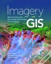
Imagery And Gis
Best Practices For Extracting Information From Imagery
idioma: inglês
Editor:
ESRI Press, Janeiro de 2018 ‧
ver detalhes do produto
ESGOTADO OU NÃO DISPONÍVEL
Venda o seu livro
SINOPSE
Today, most maps include imagery in the form of aerial photos, satellite images, thermal images, digital elevation models, and scanned maps. Imagery and GIS: Best Practices for Extracting Information from Imagery shows how imagery can be integrated successfully into GIS maps and analysis.
DETALHES
| Propriedade | Descrição |
|---|---|
| ISBN: | 9781589484542 |
| Editor: | ESRI Press |
| Data de Lançamento: | Janeiro de 2018 |
| Idioma: | Inglês |
| Dimensões: | 203 x 254 x 20 mm |
| Encadernação: | Capa mole |
| Páginas: | 418 |
| Tipo de produto: | Livro |
| Coleção: | Esri Map Books |
| Classificação Temática: |
Livros em Inglês
>
Ciências Sociais e Humanas
>
Geografia
Livros em Inglês > Outros |
| EAN: | 9781589484542 |
LIVROS DA MESMA COLEÇÃO
-
Women At ChurchGreg Kofford Books, Inc.23,16€
-
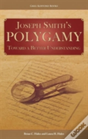
Joseph Smith'S PolygamyGreg Kofford Books, Inc.39,90€