


adicionar à lista de desejos

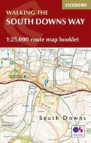
The South Downs Way Map Booklet
1:25,000 Os Route Mapping
language: english
Publisher:
CICERONE PRESS, June of 2021 ‧
see product details
OUT OF STOCK OR NOT AVAILABLE
Sell your book
SYNOPSIS
Map of the 100-mile (160km) South Downs Way National Trail, between Winchester and Eastbourne. This booklet is included with the Cicerone guidebook to the trail and shows the full route on Ordnance Survey 1:25,000 maps. The trail typically takes a week to walk and is suitable for most levels of ability.
DETAILS
| Property | Description |
|---|---|
| ISBN: | 9781852849399 |
| Publisher: | CICERONE PRESS |
| Release Date: | June of 2021 |
| Language: | English |
| Dimensions: | 106 x 166 x 7 mm |
| Cover: | Softcover |
| Pages: | 64 |
| Format: | Book |
| Collection: | Multicultural Settings |
| Categories: |
Books in English
>
Sports and Leisure
>
Other Sports
|
| EAN: | 9781852849399 |
BOOKS FROM THE SAME COLLECTION
-
10%Lima'S Red Hot Chilli In Urdu And EnglishMANTRA LINGUA14,87€ 10% CARD
-
10%Grandma'S Saturday Soup In Farsi And EnglishMANTRA LINGUA14,87€ 10% CARD
-
10%Walking In KentCICERONE PRESS18,19€
20,21€free shipping -
10%Walks In The South Downs National ParkCICERONE PRESS18,19€
20,21€free shipping